
Urbanization is cosmopolitan. And what can be an interesting yet simple way to see this urbanization transform a landscape over time? Visual imagery is the way to go. Visualization makes it easy for people to understand various phenomena, including changes that are taking place on-ground, and the scale and intensity at which these changes occur. Satellite images serve as a unique lens through which this information can be obtained. Owing to their wider frequency and visual range, satellites are able to provide information which we humans cannot obtain otherwise. In this regard, Google, through its Google Earth platform, has played a pioneering role in making it possible for the common man to easily access one of the most advanced technological innovations. The satellite used for geographic images in Google Earth circles the globe approximately once every 90 minutes, creating the possibility of having multiple images of a particular place in a single day.
At this point, I wish to pick up a case study on the rapid urban transformation of Gurgaon and its surrounding landscape, and analyze it through satellite images. Since 2006, I have often travelled on NH – 8 – a national highway which runs across Delhi, Gurgaon and other districts of Haryana. Through the years, I have not only personally witnessed, but have also heard from village folks living along the NH – 8 how green fields and open spaces have gradually been taken over by high-rise buildings and other land-uses that are associated with development. Further, with rapid expansion both spatially and demographically, urbanization in Gurgaon is fast spreading into the surrounding districts, and serves as a prime example of urban sprawl. Analyzing Google Earth images of different years, we can see how Gurgaon has transformed as a city in the last 20 years. These were some of the aspects which drew me to investigate urban transformation in Gurgaon and its surrounding landscapes.
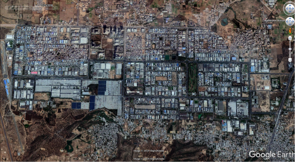
Rapid urbanization in Gurgaon led government authorities to increase the geographical spread of the district, with the addition of 58 new sectors (59 to 115) in the year 2007 (CBRE Report). These 58 new sectors together are part of the ‘New Master Plan’. The Northern Peripheral Road (NPR), the Southern Peripheral Road, and the area beyond the Kherki Daula Toll Plaza are part of this plan. NPR is a 150-meter-wide link road between Dwarka and Kherki Daula Toll Plaza, with residential and commercial development taking place alongside this road. What is also fascinating to see are the changes which have and continue to take place under the Gurgaon – Manesar Urban Complex Plan, as urbanization spreads from the city of Gurgaon to nearby districts such as Manesar. The rapid change in Gurgaon and its surrounding landscapes through the years can be seen in the Google Earth images below.
A.


B.


C.


The above case study is indicative of the utility of satellite images to study Urban Transformations. These images hold tremendous potential to enable researchers, urban planners and policy makers visualize and understand the impact of human actions, temporal changes in land use, conversion rate of forests and green spaces into concrete jungles, and interestingly, may even help us to gauge the effects of climate change. Google satellite images are one of the easiest ways to get access to information and explore a whole lot of variables. There are a lot more things that can be done with satellite images, which I hope to talk about in subsequent blogs.
One response to “Understanding Urban Transformation Through Imagery”
[…] Understanding Urban Transformation Through Imagery […]